|
We stopped
for a picnic by the roadside, a river on one side and big rocks on the
other. Meli set up the surprise entrees on the large rocks and we
dined on chicken legs, noodle-egg-cheese squares, hard boiled eggs, bread,
nutella spread, cookies, halva and watermelon. After that feast, we
knew it was going to be naptime! We came upon some farmers raking hay into
piles and putting it on a wagon to form a huge, overhanging load
which, when pulled, teetered back and forth and appeared ready to
fall over any minute. We stopped near one such load thinking
we were going to get pictures, but the tractor kept going up the
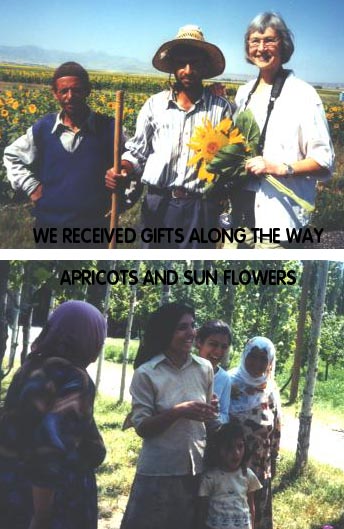
road. Instead, I spotted an apricot tree and started to pick the
ripe ones off the ground when we were surrounded by women from a nearby
house. One young woman picked apricots off the tree for me, while Meli engaged another one in conversation. The younger women
are incredibly beautiful with large brown eyes, perfect teeth, flawless
skin and slim bodies in their long narrow skirts. There always
seemed to be one very talkative, outgoing one while the others held back
in shyness.After fields of hay, the terrain turned into high rounded hills
of red. The colors were constantly changing to soft pale
shades of green, pink, and rose with fingers of tan, brown and rust
running up and down. |
 |
| Then every so often there would be a bright green oasis of tall,
slender poplar trees. There were lots of photo opts, mostly at a
distance, of shepards herding cows, and as we moved further east, sheep
and goats. The apricot tree branches were bending down with ripe,
orange fruit. We viewed many piles of dried dung squares of
different shapes and sizes along the way being stacked by the women.
We also passed many large bee colonies tended by a bee keeper who slept in
a nearby tent. The colonies consisted of many hives and were
seen often along our route. Now I know why one sees honey in the
markets all over Turkey. There are lots of beautiful wild
flowers.We arrived
at Tuzluca and toured a salt mine, which was started in 1915, 3 kilometers
in size and containing a lake 20 meters deep. 100-200 tons of salt
are produced daily. The salt is used for tanning hides, table salt,
and the animals eat salt to heal the sores in their mouth from eating
thorns. The salt is also sold to the land-locked countries that
surround Turkey. After the salt mine we went into Tuzluca looking
for a w/c when we came upon the Jandarma headquarters with two tanks
parked in front. Meli hopped off the bus to see if we could use
their facility. We couldn’t believe that she would even ask, but
guess what—they said “yes”. We ended up having a question and answer
session over chay. I think the soldiers enjoyed it as much as we
did. It gave one enthusiastic, charming fellow a chance to use his
English. It was fun. |
We stopped
on the side of the road to view a barely visible 18,000 ft. Mt.
Ararat. We were still too far away. As we approached Igdir we
noted the foothills were covered with black lava rock. A road sign
said Nahcivan and Meli said it was a small city rich with petrol.
The hills now appeared very smooth with rounding domes and had changed to
dark brown and tan with patches of pink. Saw some small rocks piled
up on top of one another and Meli said it was the way the landowner told
the shepherds, that they could not graze their animals
there.
We arrived at the
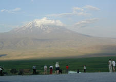
roadside village of Bardakli, where we viewed the beautiful Mt.
Ararat. When we arrived at 5:50 pm, the summit was surrounded by
clouds, but by 6:15 the clouds started sliding down the sides of the
mountain and disappearing. The mountain cleared completely only to
snare another cloud going by and it put on a circular cap again. We
were hoping for a beautiful display with the setting sun, but it wasn’t to
be. We viewed Iran 30 kilometers away. We continued on our way
to the Sim-Er Hotel, where we hoped to get a spectacular view of the
mountain at sunrise.
|

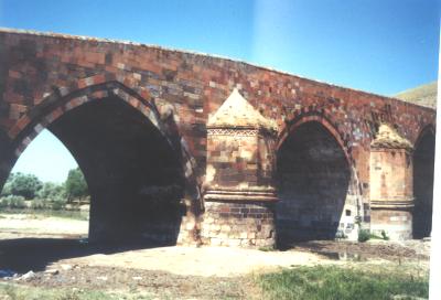
A 13TH CENT. BRIDGE ON THE SILK ROAD
|
|


