 Bozukkale
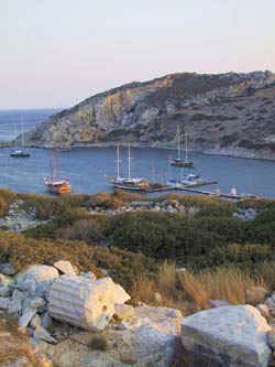
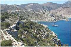
Known in ancient times as Chersonese, Bozukkale is situated on the end of Bozukkale Peninsula, which was called Loryma in antiquity. After the Gulf of Yesilova, you can steer a course past Kizil Burnu and Kara Burun to reach Bozukkale. A natural and historical harbor, Bozukkale is situated 2.4 nautical miles NE of Karaburun. In front of it are Kale Burnu and Desirmen Burnu whereas islets and shoals are found in front of these promontories. Paying careful attention to the submerged rocks in front of Desirmen Burn u in the B, this historical bay must be entered through the middle of the two capes. The sea bottom of NW inlet of this historical bay is a decent mooring point. So, after dropping anchor let’s have a swim in the bay’s clear waters.
This bay is also called Oplosika Bükü, which is a corruption of the Greek word hopleteke meaning shipyard in English, which infers that it was most likely a shipyard. This was the harbor of the ancient city of Loryma. Athenian ships utilized this sheltered harbor as a base during the Peloponnesian Wars (431-404 B.C.). hiding here for awhile on their return from Sömbeki Adasi. Again, prior to the Knidos naval battles in the year 395 B.C., the Athenian Fleet Commander Konon utilized this harbor as a meeting place. In 305 B.C., Demetrios, the son of Antigonus, who was preparing an attack on Rhodes, strengthened his fleet of 200 warships and 170 transport ships, completing the outiftting of these ships here.
 Bozukkale Harbor maintained its importance throughout the Byzantine Period as a Byzantine naval base and armory, whereas warship maintenance was carried out in this shipyard.After anchoring in this historical bay, let’s climb up to see the castle situated at the end of the cape. Measuring 27.4 m. wide by 320 m. long, and surrounded by fortification walls 2.44 in. in thickness, this long, narrow castle was erected to protect the bay.
There were once nine square-shaped ramparts along protective walls made from straight cut stones. However of the original nine, only a single promontory rampart in the N can be seen today. There are round towers situated at the two ends of the castle. Immediately in front of these towers are cisterns which were carved partly from the rock. Four of the five gates of the fortification wall are situated in the section facing N.
The ancient city of Loryma is situated on the hill to the B of the bay. If you have the time and are interested in history, it will take you about an hour to hike up the hill, whereby you can wander around this ancient city. You will find it is a nice way to regain your landlubber legs after spending so much time at sea


 Bozukkale Harbor maintained its importance throughout the Byzantine Period as a Byzantine naval base and armory, whereas warship maintenance was carried out in this shipyard.After anchoring in this historical bay, let’s climb up to see the castle situated at the end of the cape. Measuring 27.4 m. wide by 320 m. long, and surrounded by fortification walls 2.44 in. in thickness, this long, narrow castle was erected to protect the bay.
